Hikes near Hobart
Hobart is the only Australian capital with a mountain in the middle of the view, and the two closest tracks here are on it: the Organ Pipes and the Zig Zag, both about seven kilometres from the city in Wellington Park. After that the walking is a drive — the Tasman Peninsula's sea-cliff routes around Cape Raoul and the Tasman Coastal Trail, Bruny Island's Fluted Cape, and Maria Island further up the coast. It is unusually coastal for a capital: ten of these fifteen tracks are tagged coastal, and three are overnight walks rather than day trips. Tasmanian weather is the real planning variable, not the distance — the exposed sections above the treeline on kunanyi can turn in an hour.
- Trails
- 15
- Total
- 151 km
- Easy walks
- 5
- Areas
- 8
Top trails
Closest first — real distance from Hobart, not a guess from the suburb name.
- #1Organ Pipes TrackEasy2.17 km79 m upEst. 0.7 hrWellington Park
- #2Zig Zag TrackEasy1.38 km15 m upEst. 0.4 hrWellington Park
- #3Cape RaoulExpert6.73 km707 m upEst. 3 hrTasman National Park
- #4Fluted Cape TrackModerate3.34 km276 m upEst. 1.4 hrSouth Bruny National Park
- #5Tasman Coastal TrailExpert13.98 km823 m upEst. 5 hrTasman National Park
- #6Lake Osborne WalkEasy1.04 km9 m upEst. 0.3 hrHartz Mountains National Park
- #7Hartz PeakHard7.4 km384 m upEst. 3.3 hrHartz Mountains National Park
- #8Three Capes TrackExpert18.52 km880 m upEst. 6.2 hrTasman National Park
- #9Cape Hauy TrackModerate9.7 km572 m upEst. 3.3 hrTasman National Park
- #10Cape Pillar TrackExpert14.5 km1074 m upEst. 5.6 hrTasman National Park
- #11Tarn ShelfModerate3.69 km42 m upEst. 1 hrMount Field National Park
- #12Painted Cliffs WalkEasy0.25 km13 m upEst. 0.1 hrMaria Island National Park
- #13Bishop and ClerkModerate3.16 km77 m upEst. 0.9 hrMaria Island National Park
- #14Lake RhonaEasy0.47 kmEst. 0.1 hrFranklin-Gordon Wild Rivers National Park
- #15South Coast TrackExpert65.02 km2027 m upEst. 19.7 hrSouthwest National Park
All 15 trails in Hobart

SrinivasPurupati · CC BY-SA 4.0
Organ Pipes Track
Wellington Park

OlorinFiresky · CC BY-SA 4.0
Zig Zag Track
Wellington Park

JJ Harrison (https://www.jjharrison.com.au/) · CC BY-SA 3.0
Cape Raoul
Tasman National Park

Mx. Granger · CC0
Fluted Cape Track
South Bruny National Park

Greg Schechter from San Francisco, USA · CC BY 2.0
Tasman Coastal Trail
Tasman National Park

JustinH · CC0
Lake Osborne Walk
Hartz Mountains National Park

JJ Harrison (https://www.jjharrison.com.au/) · CC BY-SA 3.0
Hartz Peak
Hartz Mountains National Park

Ida Gjerlevsen Nielsen · CC BY-SA 4.0
Three Capes Track
Tasman National Park
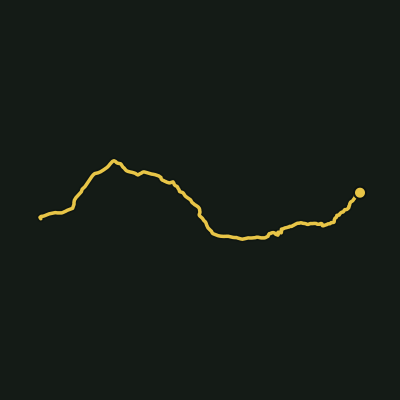
Cape Hauy Track
Tasman National Park

Lordtatting · CC BY-SA 4.0
Cape Pillar Track
Tasman National Park

JJ Harrison (https://www.jjharrison.com.au/) · CC BY-SA 3.0
Tarn Shelf
Mount Field National Park

cprevot (https://www.geodiversite.net/auteur193) · CC BY-SA 3.0
Painted Cliffs Walk
Maria Island National Park

JJ Harrison (https://www.jjharrison.com.au/) · CC BY-SA 3.0
Bishop and Clerk
Maria Island National Park

Raki_Man · CC BY 3.0
Lake Rhona
Franklin-Gordon Wild Rivers National Park

JJ Harrison (https://www.jjharrison.com.au/) · CC BY-SA 3.0
South Coast Track
Southwest National Park
Top parks in Hobart
Frequently asked questions
How many hiking trails are there in Hobart?
Aus Trails currently maps 15 walking tracks in Hobart, covering about 151 km in total. Every one has a real elevation profile and a 3D terrain map, and all of it is free to use without an account.
What is the longest hiking trail in Hobart?
The longest Hobart track in our catalogue is South Coast Track in Southwest National Park, at 65.02 km with 2027 m of cumulative ascent.
Which Hobart trail has the most elevation gain?
South Coast Track in Southwest National Park climbs the most of any Hobart track we map — 2027 m of cumulative ascent over 65.02 km.
Are there easy walks in Hobart?
Yes — 5 of the 15 Hobart tracks we map are graded Easy, meaning short distances on well-formed track with little sustained climbing. You can filter the full list by grade on the trails page.
Which national parks in Hobart have hiking trails?
The best-covered areas in Hobart are Tasman National Park (5 tracks), Hartz Mountains National Park (2 tracks), Maria Island National Park (2 tracks), Wellington Park (2 tracks), Franklin-Gordon Wild Rivers National Park (1 track).
Do I need to pay to use Aus Trails in Hobart?
No. Offline maps, live GPS, elevation profiles, 3D terrain and every safety feature are free, permanently, with no account required. Pro only adds planning extras like custom route building and printable maps — nothing that keeps you safe on trail sits behind a paywall.